Sometime during the 1990’s, before the last student Union remodels had taken place, I met a long- distance hiker who had hiked the entire Wonderland Trail around Mt. Rainier. This adventurer brought his journey to life via a slide show and narration in an evening performance that was attended by a very large audience which included many college employees. It was a very well-made documentary of his travels on the 95-mile long trail that meanders around the circumference of the entire national park. I was intrigued by this performance and had a great talk with the young fellow who had completed the epic hike.
 |
| Clear Lake Falls |
Shortly after the slide show, I was looking at a map of Mt. Rainier National Park and decided that the time was not right for me to quit my job and set out on an adventure like we had seen through the lens of the hiker’s camera, but I could possibly use the map to inspire others at the college to get into better shape via a wellness program.
 I took the map and placed it on a bulletin board located at the entrance to the Student Union Building. The program was advertised to all employees and students through our fledgling College Wellness Program and anyone who wanted to could sign up to “Walk the Wonderland Trail around Mt. Rainier!”
All who signed up would get a colored push pin with their name, or trail name, on it. As they exercised each day they would send me their activity report and I would then give them “miles hiked” calculated by a formula I came up with and wrote into the rules of the hike. The “miles hiked” would be recorded accordingly on the large map of the mountain trail via the push pins with their names. Participants could follow their progress around the Wonderland Trail while getting in shape.
 |
| Mt. Rainier and blue sky. |
On Monday, Linda and I crossed the Wonderland Trail several times as we drove through Mt. Rainier National Park. When we first saw the trail signs announcing that the trail would be crossing our path, I remembered fondly the wellness program and the slide presentation that all took place some 25 years ago. Linda got to listen to me tell the entire story as we drove through this magnificent park. It was a last-minute decision to detour this direction, but we both agreed we made the right choice.
 |
| Trillium! |
Our plans were to drive west via I-90 over to North Bend and then go through Auburn to Olympia where we would then head to Olympic National Park to explore before we joined Don and Caroline at Ft. Worden State Park near Port Townsend. The change to drive through Mt. Rainier National Park came when we were looking at the map the night before we left and said, “What the heck, we have seen I-90 a million times.” When we hit Ellensburg, we turned south and that is how the adventure began.
 The first eye-opening sight came just after we passed through Naches near the headwaters of the Tieton River. The Tieton River is a dam-fed river that I have run several times in my cat, all with the College Outdoor Pursuits Program. The water is released from the Clear Lake Dam and it flows about a mile down to the Clear Lake Waterfall. We stopped and explored this overlook, taking about a hundred pictures that do not do the falls justice.
 We continued on and rounded a corner where we pulled off and got our first vistas of Mt. Rainier. The day was beautiful with wispy clouds in the sky. Rainier was spectacular. As we drove we wound our way into the park, stopping frequently for overlooks and sightseeing stops. We could have spent days exploring, but we needed to get to the Cougar Rock Campground and find a camp site. It was Friday and we had no reservations, so we kept our fingers crossed and pushed further into the park.
  |
| We made it to the ocean! |
Cougar Rock Campground was nowhere near full when we arrived. We found a nice spot and set up our camper. We walked around the campground, sat in the sun, ate dinner and then finally went to bed. Our last minute detour was deemed a great success. We knuckle-clacked and went to sleep.
 |
| Ocean Shores kites! |
8:00 am and our diesel chugged its way out of our campsite and on down the road heading to Longmire, Ashford, and Elbe, where we would turn south and follow Highway 7 to Morton. We then followed Highway 12 to I-5 where we turned north and cruised up to the exit to Essex, which put us heading west on Highway 12 again. Elma, Aberdeen and finally Hoquiam came and went. I feel like I am sounding like an old train conductor announcing stops!
We refueled in Aberdeen and spent a little time looking at the map and talking about what we wanted to do for the next day or two. I have been over in the area many times, but Linda had not. The Olympic National Park had been one of our goals for the trip, but now that we were this close to the ocean, we were being drawn to find a campsite close to the water instead of snuggled into the forest.
 Linda looked at the map and said, “How about going to Ocean City State Park?” We headed out of Aberdeen through Hoquiam and followed Highway 109 up towards Ocean Shores. At the park, we found a site and set out our chairs. Once we had claimed our spot we paid and then drove out of the park and followed 109 north, all the way up to Pacific Beach. The sightseeing was spectacular due to the beautiful weather.
We returned to the State Park entrance and at the last second drove past our turn and went on to Ocean Shores to see what was happening.
 Luck was with us! There was a big kite festival on the beach with hundreds of kites of all sizes and colors. We walked the beach enjoying the spectacle. There were vehicles, bikes, RVs and spectators everywhere. We walked a huge loop up the beach and then back through town to our truck.
 We hurried back to the park and got the rig set up and ready for the afternoon. Once this was done we took our bikes and rode through the campground and onto the beach. We’d never ridden our bikes on a beach before. Looking south we found that we were within a couple blocks of the kite festival! We rode down the beach and checked out the kites from the other direction. We had a blast watching all the people and taking in the spectacle of the kites.
Returning to the camper we enjoyed the rest of the warm sun, had dinner and went to bed.
 Linda got up and went for a run while I fixed coffee and tea for the morning wake-up. We leisurely packed up and hit the road by about 9:00 am. We followed the ocean north to Copalis Beach and then turned inland. From the beach, we hit Copalis Crossing and then made our way up to Humptulip where we connected with Highway 101 which we followed past Quinault Lake and on past Kalaloch and into Forks, where we bought a snack of doughnuts. We felt we needed to continue the celebration of National Doughnut Day, which took place the day we left on this trip.
 |
| Crab, squid, and other sea creature kites,. |
At Forks, I continued to tell Linda stories of the many trips that I led to this area when I guided students on adventures over their spring breaks. Linda listened as I went on and on and on (the editor added some more “ons” to the prior sentence) about these trips. She smiled and acted like I was telling them for the first time, even though I know she had heard them many times before.
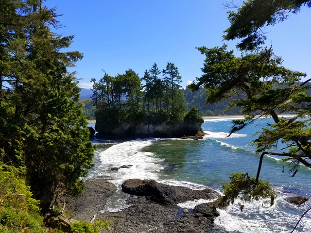
Out of Forks, we followed Highway 101 up to Sappho, where we turned left and took Highway 113 until it joined Highway 112 and followed the coast along the Strait of Juan de Fuca. This must have been the curviest highway in all of Washington. When it said 10 miles per hour, you had better slow down!
 |
| Linda and cow kites. |
Our destination was Salt Creek Recreation Area and when we arrived we were so ready to get out of the truck that we didn’t explore the campground and took a site with a spectacular view of the Strait. Later, after we were all set up and rested, we walked around the entire campground and found some real cool sites. All of the real nice ones were in the shade, however, and we decided that with the wind off the water, it was good to have a site in the sun.
 Linda checked out the tide tables and found that low tide would be at 6:00 pm and she wanted to go tide pool exploring when the pools were at their best. We spent the afternoon hiking around and sitting in the sun. At about 4:30 we walked to a beach access stairway and went down to the rocky coast. As the tide receded we climbed around on the rocks poking under boulders and gazing into the pools trying to identify sea life. We found a dead stingray… well, its head anyway, and a bazillion mussels. Linda was a bit disappointed not to see starfish, but the sun and shore was a great place to spend the afternoon.
We hiked back home and on the way spotted a raccoon. I cooked up dinner and we ate as the sun set watching the huge ships out on the strait. As soon as the sun set the air temperature got really cold, so we both snuggled inside and played cribbage. Tomorrow we will travel to Fort Worden where we will meet Don and Caroline.
 |
| Taking out bikes to the beach. |


 |
| Salt Creek Recreation Area tidal pools. |

 |
| Crocs and Socks! |


2 comments:
Nice blog. Enjoyed reading it. Thanks for sharing your blog with us.
Annapurna Base Camp Trekking-14 Days
Very beautiful post. Thank you so much for sharing this post with us. Everest Base Camp Trek 10 Days
Post a Comment