Showing posts with label Jeep Exploring. Show all posts

Thursday, August 31, 2017

Smoke Gets In Your Eyes

The Old Pipeline Bed Trail.
The next day was a traveling day. We all packed up and drove US-97 and US-2, which took us through Brewster, Lake Chelan, Wenatchee, and finally, Leavenworth to Nason Creek Campground where we were to camp for the final three nights.
   
As we neared Leavenworth the smoke from forest fires near the Cle Elum area filled the sky. For the next few days we were faced with smoke-filled valleys and at times, ash falling from above.

The following morning, everyone wrapped up in their jackets and hoodies and we drove back to Leavenworth and then out Icicle Road. We wanted to hike the Icicle Gorge Trail, but as we drove up the valley we noted that the smoke from the wildfires was super thick. We talked about options and decided to try this hike the next day in hopes that the smoke would not be as bad.  Changing plans, we drove back into town and up the highway to the Old Pipeline Bed Trail. This hike leads along the Wenatchee River. It starts by crossing the river on an old half pipeline.
Note the pipe creates the bridge floor. 

As we hiked we noticed that there were spawning salmon lining up in the pools, resting before they continued their journey up to Lake Wenatchee. We spent some time watching them Jump and circle as they hung in the pools.

Grant and rock.
We came to a rocky cliff area and decided to turn back. As we walked we all talked and laughed. We came around a slight corner on the trail and there was a small bear standing, looking over its shoulder at us. As soon as it saw us, it bolted down the trail. Grant gave a shout and I grabbed my camera. I was able to get two shots of the bear butt as it scampered off the trail. That was a very cool animal moment and it made our day.

Fish at rest.
We arrived back at the trailhead and jumped into the Jeep and drove back down to Leavenworth. In town we walked around the crowded streets, checking the shops and searching for a place to sit and eat. We stumbled upon the Blewett Brewing Company where we grabbed seats in the air-conditioned dining room. We ordered pizza and salad and enjoyed a delicious lunch. After lunch, we walked to the Gingerbread Factory and bought a couple of snacks to go.

Linda calls this one "Jumping Salmon."
We returned to the campground and we fixed dinner. After we ate we continued the championship and by the end of the evening the score was tied at six to six.

Morning arrived and we checked the sky. It was still smoky and looked to be another hot day. We drove down to the road that lead up to the Icicle Gorge Trailhead. This time we kept on driving on up to the trailhead parking lot. The smoke was bad, but we didn’t have the possibility of waiting another day for the wind to change and blow the smoke out.

Bear butt!
The Icicle Gorge Trail (River Loop) was a very nice, well-used hike that wound down along Icicle River, crossed on a foot bridge and then continued up the river. The trail system formed a loop and made for a very nice hike along the water’s edge. The hike was very nice, but it would have been spectacular if we could have been able to see all the peaks and crags of the high mountains around us. The smoke was so thick the mountain tops were just vague outlines in the distance.

After the hike, we were on a mission to get a brat and wound up at the Munchen Haus where brats were their claim to fame. We finished our visit with a stop at The Fudge Factory where we all purchased a little sweet treat. The drive back to camp was hot; ash from the fires dusted us as we snaked along the highway.

Our final evening was spent sitting down by the river. Ash fell on us, but by then we had become accustomed to it. We cleaned up and gathered to play our final evening of Skip Bo. Canada had a great final showing and took home the gold. I sang a very poor rendition of “Oh, Canada” (we gotta memorize that song) and we all retired for our final night’s sleep.

Next morning we all packed up and went our separate ways. It was sad to say goodbye, but we had a great few days with Jacquie and Grant. We look forward to more adventures with them. Hurry up and retire, Jacquie!

Down town Leavenworth.
Icicle Gorge and the bridge. 
Along the trail.


Jacquie and friend talk about the forest fire smoke.

Dams and All That

Chief Joseph Dam overlook.
Bridgeport State Park is a very nice small park located on the Columbia River, just outside of Bridgeport, Washington. This park is about 152 miles from Post Falls and takes about 3.5 hours via US 2 W and WA-174 W. We have driven most of the roads on previous trips and so our trip over to the park was a nice drive; uneventful but pleasant.

Grant and Jacquie at Grand Coulee overlook.
We arrived around 1:00 PM and set up in our site, #1. Within an hour Grant and Jacquie arrived and once again we were together for a bit of an adventure. We spent the first evening talking and laughing, ate dinner and then played several games of Skip Bo.

The next morning we loaded into Stinky Jeep and drove past Chief Joseph Dam. The weather was clear and very hot. You might say it was a hot dam day. 

The city of Grand Coulee and the dam.
At the Chief Joseph Dam information pull-out we read the signs at the overlook. It was interesting to read about how the dam was constructed. On to Grand Coulee, where we drove to the overlook and took some photos. 

We took some time to explore the dam visitor center where we watched a movie and explored.  It was very interesting and we learned quite a bit about the history of the lands around Coulee City and the building of the dam.

Creating rivers.
Part of our day's plan was to visit the dam and then drive down to Steamboat Rock and hike to the top of the basalt cliffs. Once we parked at Steamboat and started our hike, we noted the time and how hot it was and decided it might be in our best interest to cancel our climb and go try a different hike. The Northrup Canyon hike had potential to be in the shade part of the hike, so we drove there.

Peek-a-boo!
Northrup Canyon was about six miles back in the direction of Electric City We hiked the upper trail for about a three-mile round trip. The climb was in the shade all the way to an area of switch backs and we made that point our turn around. The hike gave us some great vistas looking back at Steamboat Rock and Banks Lake.

By the time we got back to the Jeep we were all famished and so we drove into Grand Coulee to the Pepper Jack Bar and Grill. We chose this place to eat based on several things. One, it was a Bar and Grill; two it was old, and three it was for sale.  How can you go wrong? We had a very good meal. Everyone got their fill of flavorful restaurant food, served by a nice lady in an air-conditioned old Bar and Grill.

Before and after our Steamboat Rock hike.
It was rather late when we drove back to the park so we decided not to have our planned meal and changed to an easier-to-prepare selection. After dinner, we played Skip Bo and of course, I started smarting off about the US beating Canada in the Skip Bo Championship. Everyone ignored me, but I could feel that the competition was elevated. We went to bed with the series tied 3 games to 3.
Tons of old cans from the dam builders camps.
View from the Northrup Canyon hike.

Thursday, May 19, 2016

31 Years

Anniversery drive up the Joe.
I sat across from the crackling hot fire and looked at Linda. She was smiling, looking deep into the fire. My heart swelled and all I could think about was how lucky I have been. In my head, I did the math. I am 61+ years old and this anniversary was our 31st since our wedding.  Add on the four years of living in sin (as the parents called it) and we have been side by side for more than half of my life. There is not a minute of that time that I would change; we have had a gifted marriage together.

Every day we laugh at each other’s crazy quirks and just enjoy being together. When Linda goes running every day, the clock in my head keeps track of the time and if I think she is late I start to worry. I am usually there to meet her with Kobi in tow when she returns.

We laugh at Linda’s fierce desire to win in cribbage every time we play and at my stupid playing errors to boot. Beyond loving each other, we really have fun together and have laughter there to keep us grounded.

On this special day, we took a drive and talked a lot about being together and never leaving each other.  May 18th, Mt. St Helen’s Day, our day!

 Spending time out camping on our special life-event days is something we have always done. Being on a river on Linda’s birthday, or getting out and about on mine, is something we always do. This week we had planned to be up the St. Joe River so that we could get a good campsite. Plans were that Holly, Ryan, Zane and Anika would be joining us on the weekend and we were the site grabbers.

Our drive up to Huckleberry Campground on Tuesday was uneventful. Our new truck tires performed well, I guess that was $1700 well spent (I have to keep saying that.) The truck was very full and we were towing the Jeep, so when I got the tires filled I had them put air in our air bag lifts (they did that for free), but I think I put too much in. The ride was different from our last trip. I will experiment with some different pressures.

The camp site we secured was one we have been in before. It has great privacy and is big enough for the size group we might have gotten. We set up the gear and enjoyed the midafternoon.  I got my fishing gear on and went to the river for some fun.  The water was high and fast, but clear. There were fish rising in the slack water of the inside corner where the campground was. I fished there and caught several big fish.  Like all fly fishermen, I changed to different flies trying to tempt the big guys. As I have gotten older, fly fishing has gotten a bit more complicated. My knees keep me from moving about as I used to and my eyes have made it so that I can’t change flies at the drop of a hat.  I have tried to compensate by moving less and using a set of magnifying glasses.

I switched flies and stepped out into the current. I flipped my line and for some reason, things didn’t feel right. I looked down at my vest and couldn’t find my fly box! It was gone! I always take the time to zip it in to its spot, but it was gone!  I reeled up my line and looked downriver but couldn’t see anything.

For the next thirty minutes, I searched the bank, all the small eddies and pockets. I even hiked downriver and waded up looking for my favorite dry-fly box. It was gone!

Needless to say, I was crushed. Walking home all I could think about was all the great flies that just went downriver.  Linda knew something was up when I walked into camp. I knew there was nothing I could do; Linda comforted me as best she could, but I was lost. The box I spent years collecting special flies for specific rivers and conditions was gone.  The only dry flies I had were in my box of Stimulator patterns or in a place where I had hurriedly stuck a fly that I changed off my line. The evening was shrouded with my misery; we played cards, Linda beat me, and we went to bed.

Eagle on log across the river. (Linda's photo)
Our anniversary day was here and I shrugged off the prior evening losses and looked forward to a new day. Linda went running and I baked crumb cake to celebrate our 31 years. We took a long drive upriver to Red Ives and then returned and had a great dinner. It was a great day and we enjoyed being with each other and thanked our lucky stars for the life we have.

Cell Phone Point
One of the neat things about camping at Huckleberry is that you can drive straight uphill out of camp to a point and check your cell phone. It is three miles of the steepest, rough road that you can imagine. You drive up using your first gear and round a corner and right there at the side of the road is a post with a phone on it. The sign reads Cell Phone Point and sure enough as soon as you round that corner, your phone starts beeping and loading everything that has arrived since the last time it was able to connect. How funny is that? The phone on the pole is made of wood, but it sure looks real.  We drive up the road about once a day or so and get our internet stuff caught up on.  Wow, we can even Facebook up there!

And I forgot my quarter.
Last time I was sitting up there I thought of starting a” Go Fund Me” site to help defray the costs of replacing my bazillion dry flies I lost. I know there are fly fishermen out there that understand my loss and would donate to this tragic loss. I wonder if you could deal in flies instead of money on a site like that.


Dinner was Linda’s favorite Costco meal, ravioli. We picked everything up outside and went to bed. At 11:15 PM a huge storm came in and the rain was amazing. We got up and closed all the vents and windows, keeping us dry and happy.  Thunder started so I put on some cloths and went out and brought the dog into the camper. He was scared to death and I really had to coax him out of the truck. Once in the camper he relaxed and went to sleep, and so did we.

Tuesday, May 03, 2016

A Jeep Day

The weather was amazing today so Linda and I got in old Stinky Jeep and drove up over Fernan Saddle down into the Coeur d'Alene River drainage. We hit some snow in several places but mostly there was only mud on the road.

Over the saddle, we drove down the South fork of the Coeur d'Alene and then turned and headed up over the pass and down into Teepee Creek.

Once there, we drove on down to the Coeur d'Alene River and checked out the entire river. While we drove we spotted several deer and a herd of elk. The water was running clear and cold. One of the side trips we took led us up to Fern Falls and Shadow Falls.

Saturday, September 06, 2014

Lakeview via Jeep

Reading the map, keeping us on track.
Once we finished up the odd jobs we had around the place we jumped into the Jeep and took a drive.  We north to the Bunco Road then into the woods from there.  We followed FSR#233 up to the ridge and then dropped into a small town called Lakeview.  We talked to a couple people and found that we could make a loop drive by heading up and over Bernard Peak.  There were two real nice view points that we stopped at to rest and take pictures.  It was a fun little drive and we enjoyed the entire trip.
View looking toward Bayview.
Looking north towards Sandpoint.

Looking for a few bars at the overlook.

Tuesday, October 08, 2013

Bees and then Rain

Sunset at the bee camp.
What better time and day to leave to go camping then 11:11 AM on a Sunday afternoon.  The plan was that every weekender would pack up camp by about 1:00 PM and head back to get ready for their work week. The Bennetts, on the other hand, were ready to get out and freeze their little butts off.

Our destination for this week was the old Coeur d’Alene River.  We had not camped up the river all summer and we felt that with the colder weather we would get a chance to see some of the early fall colors. We didn’t have an actual camp area picked out, we were just going to drive and see what was available.

Checking where we went and where we are going.
Camp turned out to be the one we call “the rock beach” camp.  It was the camp that we were staying at when we locked our keys in the truck and had to call Rayelle and Mike Anderson to drive up and rescue us. The camp was open to the sun which would provide warmth for our souls as well as solar power for the camper.

Set up was quick and as we established camp we noticed one thing. Yellow Jackets!  We were there and our gear was set so we decided to get in the Jeep and take a drive.  It was early afternoon and our plan was to be out long enough so that it got cold and the bees would go in their hive.
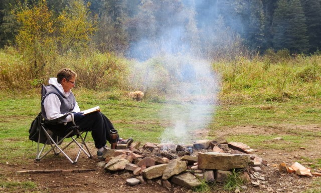
Books and tea by the morning fire.
We jumped in Stinky Jeep and drove upriver to Flat Creek where we followed road #400 up into the back country.  #400 was a good road; it wound around and curled up over Flat Creek Saddle and then dropped down to Steamboat Creek.

Now I make it sound like we knew where we were all the time, but actually we had forgot the map back at camp and were driving blind. We knew that we would eventually come upon a directional sign or a map. Eventually we did just that!
 We ended up following Steamboat Creek down where we met the old Coeur d’Alene River Road located on the opposite side of the river that we had traveled up on.  We drove downriver and were able to cross over to the regular road at the bridge leading up the Little North Fork in the direction of Bumblebee Campground.
This put us about 33 miles downriver.  If you were to look at a map, you would see that the river made a big V with the main river road following it. We had cut straight across from the top of one arm of the V, directly to the top of the other arm by way of several ridges.  We figured all this out when we got back to camp and looked at the map.

Pbbbt... Hunting season starts next week!
The trip in the Jeep worked to keep us out of the bugs and when we returned the sun set and we had our dinner.  We heated up leftovers and played cards until we couldn’t keep our eyes open. It was a cold night but our bed was warm and comfortable.
 The next morning the valley was fogged in. We built a fire and warmed up with coffee and muffins.  As soon as we got ready we were in the Jeep again. This time we had a map, food, and water.We drove down to Teddy Creek and followed road #802 up along the ridge tops.  We stopped several times and looked for game, but found none.  We did however find a real nice stack of firewood which we loaded into Stinky.  The road wound around and then dropped down to the main river road at Venus Creek.  We really liked this road; it was very smooth and had some great views of the mountains around us.
Hot baked goods and coffee!

Back at camp all hell broke loose.  The Yellow Jackets were out with vengeance in their eyes.  They were everywhere and relentless.  Linda and I made the decision to get the heck out of there so we packed up and fled.  We ended up down river at Juniper Creek camp.  It was just off the river road, but provided a spectacular view upriver.  We spent the evening watching the water flow and the leaves change color; happy that we made the move.
The rain came in just before sunset and continued through out the night.  We broke on of our rules and let Kobi in the camper. It was just to wet and cold for him to be out side and it would be a real long night if we stuck him in the truck.  He enjoyed being with us, but when the thunder came through, he climbed under the camper table.
How would you like looking at this every morning?
The rain continued and we went to bed.  The next morning we awoke to more rain.  For breakfast I baked orange rolls in the oven.  We sat and drank coffee eating hot rolls. Linda was looking up river when she spotted a cow Elk walking down river on the far bank.  We had taken two drives over the past two days.  Our goal was to spot some game and we saw nothing.  All it took was a couple of hot drinks and some fresh baked goods and the game just paraded in front of us.
By 11:00 AM the rain had not let up so we decided to pack it up and come home.  We could have stayed and kept warm and dry in the camper, but we'll have plenty of days ahead to do that.

Saturday, September 14, 2013

Because We Can!

It was up the old St. Joe again for this camping trip.  We drove down via Rose Lake and immediately hit road construction.  They are resurfacing the highway from Rose Lake down to the turnoff to Harrison.  We followed a line of cars moving at 15 mph all the way through that entire section of road. After that it was smooth sailing all the way up to Huckleberry.
At Spruce Tree Campground.
 We drove through the campground and noted that all the nice sites were filled so we headed up to the areas beyond Avery. 

Driving through the zone where all the contaminated soil had been we saw that all the digging was complete and the equipment was gone. The land next to the river was smoothed flat and had been graded to let nature try to take back over.  It was nice to see all the heavy equipment gone, hopefully the earth can recover.

Not too concerned about finding a camp site, after all it was a Tuesday after Labor Day, and people should be out of the woods and back to a normal existence. The first noted camp past Avery was Packsaddle. It was empty and since we had never camped there we stopped and claimed the first spot. Site one is the biggest and right close to the water, the other spot is smaller and a bit harder to get into so we hoped we would have privacy for a few days.
"Take the lens cap off the lens!"
Got our camp set up and cooked hotdogs over the camp fire.  It was a good night and we went to bed at about 9:30 pm.

Wednesday we took a long drive up river to the end of the road. We used to come up the St. Joe a lot when we were younger, we would drive up to camp, fish, and many times raft this part of the Joe.  It had been probably 16 years since we had been up this far.  There were a lot of changes that we noted, biggest being that the road was paved all the way up to Spruce Tree Campground.
When you come to this sign, you just have to go there!
We turned around at that last campground and drove back down checking out all the campsites as we returned home.  Linda noted them on the map for future visits and gave them the thumbs up if they had potential.

Ate lunch on the way back and when we arrived back at camp, I set up my fly rod and went fishing as Linda read her book.
Fishing was slow and there wasn’t much of an evening hatch coming off the water.  I caught one good one and called it a night.  We ate dinner played cards and went to bed.

Our Thursday adventure took us down river just past Avery on the south side of the river.  We hung a right up the West Fork of Fishhook Creek (Road #201) and followed it all the way over to the Lake.  Dismal Lake was the butt of our jokes all the way there.  When we arrived we saw a cute little lake that a logging operation had made into a dismal place.  These people had placed their two trailers next to the road which was next to the lake and then they had brought every kind of junk used for logging into the nice area. They had dragged logs into the lake and created a dock for their camp which ruined the whole mystique of the quaint little lake. The whole campsite made the area take on the literal meaning of this lakes name, Dismal.
Doing our best to look dismal.

Mammoth Springs Campground was a mile further on the road according to the map.  We drove till we saw a sign showing that Bear Jaw and Mammoth with one arrow pointing to the right.  We followed the arrow and wound up at the top of Trimmed Tree Hill.  No campground up there, so we backtracked to the fork in the road and read the sign again.  The arrow pointing left to the Mammoth Camp Ground had been shot off and that section of the sign was in the bushes so we didn’t notice it.  The campground was about 50 yards beyond the sign.
Looking Northwest on Trimmed Tree Hill.
Mammoth Springs Campground is a testament to our Forest Service dollars at work.  There are pit toilets, running water and campsites scattered throughout a roughed out area. The camp is there, but it looks like it is seldom used.  Most all the sites are grown over with brush and grass.  It actually looked like two sites had been used this year. Lots of money spent to put in the camp, but little thought of how far and how hard it is to get to, a little ghost town of a campground.

After that stop we drove down Bluff Creek to the main road and back to camp.  The round trip was about 60 miles of good gravel road. We were dusty but enjoyed the whole adventure.  We ended our day by driving into Avery for ice cream at the Idaho Fly Fishing Company shop.

On Friday we drove to the North Fork of the St. Joe River and went up to the Squaw Creek Campground.  To get there you go through three tunnels which were real cool.  At the campground, which was almost completely empty, we parked and hiked up the Squaw Creek Trail to the top of the ridge. We figured the hike was a little over a mile and a half out and then back for about three miles total.  It was a good trail but very steep in places.

After driving back to Avery we stopped in to the shop for an ice cream lunch and then drove back to camp.  At camp we noticed that an RV had taken the second site so we were now not alone. 
On the hike up Squaw Creek.
We sat out and read and then built a fire.  As we sat playing cribbage I finally recognized our new neighbors as a former NIC student that had gone on an Olympic Coast trip with me over spring break many years ago.  I goofed up by forgetting that Kobi was not tied up and I went over to their camp to introduce myself.  Kobi followed me and since they had two dogs, all hell broke out.  It wasn’t a pleasant meeting.

Our neighbors were Scott and Colleen Thompson from Rathdrum.  They are teachers in the STEM Academy which they set up a few years ago.  Scott said he remembers the Olympic Coast trip very fondly and complemented me on the entire experience.  We talked and tried to remember common things from his NIC experience.  It was nice to meet them again.