Showing posts with label Ruins. Show all posts

Sunday, February 20, 2022

Besh-Ba-Gowah

We put Stinky Jeep to another highway test today. Our destination was Globe, AZ, and to get there we had to drive east to Superior and then on up over a pass to the mining town of Globe. We had no true destination on this drive, it was just a get out of QV trip. 

Once we got going Linda, looked up Globe on her phone and we found that there was a historical site called Besh-Ba-Gowah located right in the middle of town. So we drove on in and paid our four dollars each for entrance.

Once again we found a great site with such a grand historic background. The Wikipedia page for Besh-Be-Gowah explains it much better than I could. 

Linda and I walked through the museum and watched a short movie about the area's rich history. After that, we walked the ruins and took photos. 


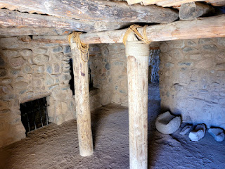
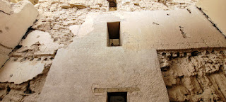
The buildings on this site had multiple floors; up to three levels plus the rooftops


A Ceremonial Room.


Reconstructed room.

All pots and artifacts have been unearthed
from the various excavations on this site.


Unexcavated rooms.


After our tour, we went to a Mexican fast food place and had lunch. Then we headed back to our little home. From what we viewed in the ancient living areas of Besh-Ba-Gowah, the inhabitants had larger indoor living spaces than we do in our camper.

Thursday, February 03, 2022

Holes & Hohokam

There are signs left by ancient peoples all over this area. In the short time, we have been here, we have visited at least six places where these people have left either pictograph, pottery shards, dwelling walls, or other signs of their lives in the past. 

Today, I went with Rolly Jurgens on a Razor ride to some pictographs and then to some holes in rocks that were said to be made by the Hohokam Indians. (Link takes you to the Wikipedia page for Hohokam Culture.) It is said they inhabited this area about 300 to 1700 AD and left all sorts of signs for us to wonder about.

The holes in the rocks are very interesting. These are said to be carved into the very hard stone by the Hohokam as they ground seeds to make the flour they would bake and then eat. They definitely do not look natural and very much look to be man-made. 

Both Rolly and I had many questions that we could not answer. Why were they located at this spot?  The area where the pottery shards are abundant is much farther upstream. Why would they camp so far away from their seed grinding spot? Did they farm the flats near the rock holes and then use the grinding holes next to the fields and carry the final ground product up to the living site in clay pots?  We talked and talked about all these questions, most of which we may never know the answers to.


The holes in the rock are said to be used to grind seeds.


A pottery shard found on a
"bench" above the stream bed.

Monday, January 17, 2022

Casa Grande

It was laundry day and I also needed to get a couple things for maintenance on the camper so Linda and I grabbed old Stinky Jeep and headed into the nearby town of Coolidge.  As Linda loaded the clothes into the washer, I walked to a nearby Farm Tractor Store and found the two items that I needed.  Then I went to the nearby Walmart and exchanged my propane tank and filled up with gas.  All this took about an hour and a half and when I returned I helped Linda fold the clothes and we were off to explore.

On the north side of Coolidge, the Casa Grande Ruins National Monument is located at the corner of Hwy 87 and 287. This ancient building was built by the Hohokam people and was completed around 1350. In the 1800s scientists worked to get the structure protected but that took about 92 years for our government to make it happen. In 1992 Casa Grande became the nation's first archeological reserve. Information on this structure and its history can be found at www.nps.gov/cagr.


After we explored the monument site we had lunch in Florance at a small Mexican food eatery called Grace Place. We both had burritos and we took them to go and ate in a nearby park.

View of Queen Vally RV from a hill to the south.

Climb Every Mountain

If you look at a Google map of the Queen Valley area in Earth view, you will be able to spot the RV park and the surrounding geographical features of the Valley. To the west of the park is a ridge that runs north and south. On top of one of the peaks on that ridge is a tall rock outcropping. Some of the RV Park residents have placed an American flag and a light to illuminate it during the night. I hiked up to the top of the ridge and got a picture from that area of the east side of the ridge, the west side of the ridge, and a selfie at the top of the rocks.  It was a good hike and it took me about an hour and a half to climb there.