Over the past month Linda and I have been watching the weather; following current fire conditions and deciding on several camping spots that we could take our friends, Jill and Barry Urquhart, to when they visited us from their home in Canada.
When they arrived on Thursday, they immediately invited us to join them on the next part of their adventure down south, which meant we were heading to Yellowstone National Park.

We spent the next couple days showing them Coeur d’Alene and packing supplies in our camper. It had been a long time since either Linda or I had been to Yellowstone, so long that most of what we remembered was buried in cobwebs in our brains. Jill and Barry received the down-and-dirty tour of our area. We took a boat ride on the lake, tooled Sherman and did a bit of downtown shopping. But mostly we planned and packed for our next great adventure.

We left Post Falls at 9:30 AM on Sunday and drove east on I-90 past Missoula to our first night’s stop at Fairmont Hot Springs. Once we had checked in and set up we grabbed out swim suits and headed for the steaming hot water of the pools. I can’t believe that it only costs $5.75 each for a relaxing swim in the pools. We have had campsites that charge $3.00 for six minutes of shower time; this activity was a real steal.
The hot pools sucked the energy out of us and we wandered back to our rigs for drinks, dinner and a game of cards. We hit the sack early knowing that we would be up and out on the road early enough to get down to a camp area just outside the park.

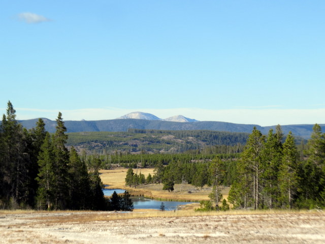
Loaded and ready we drove through Butte and turned south on Highway 191. Barry led the way and we made good time down to our camp destination at Baker’s Hole Campground. Baker’s Hole was suggested to us by our friends Daren and Marcy. They have stayed there several times when they ventured down this way to fish.

We found two great campsites and got our rigs set up. Then we jumped in the Barry’s truck and drove into West Yellowstone to get the lay of the land. We shopped. I got a hell of a deal on some waders at a fly shop. It was an end of the year close-out or I would have never bought them. Linda sort of insisted that we didn’t pass up the deal; I think she was tired of hearing me whine about wet feet every time I went fishing.

Barry drove us to the park entrance and we picked up some maps and info sheets so we could do our research and set up a plan for exploring the next day. We drove back to camp and sat by the Madison River and had drinks. After dinner, we planned our adventure and went to bed. I slept in my new waders that night with visions of rainbow trout dancing in my head.
There are 2.2 million acres of land to explore in the park boundaries; we made the decision to divide the park into two loops. We would drive one loop on Monday and then explore the second loop on the next day. 2.2 million acres is a lot to explore, even if you divide it into two loops. By the end of day one, we had decided that we had misjudged this park and that a good exploration of the minimum sights would take at least a week. Here is what we accomplished in our two-day hurricane adventure.

We entered the park through the West Entrance and followed the Madison as it wound its way beneath the shadow of Mount Haynes and National Park Mountain. We must have passed a million fishermen, spaced approximately 30 yards apart knee-deep in the waters of the Madison. Our first big game encounter was a huge lone Bison walking the highway’s shoulder. We paused just long enough to get a photo and then we were off.
Several miles later we came upon a heard of bison resting in the mist of venting steam. Here we pulled off the road and got some great pictures before we drove on. At the first junction, where the Gibbon River and the Firehole River meet to form the Madison, we turned south.

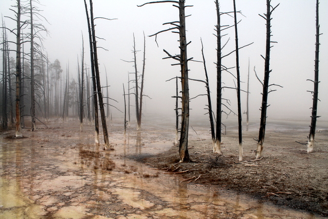
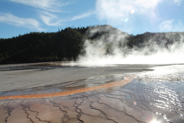
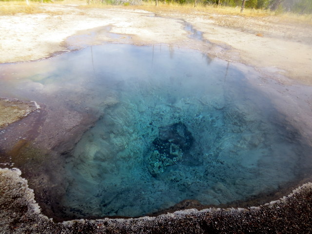
Our first stop was the Lower Geyser Basin. Since we were early in the day, the entire area was shrouded in mist from the various thermal features. We walked among the geysers, springs, and vents, steam rising into the blue sky. I took many photos as we walked. An organized photographer would have taken a shot of each feature’s names, then a photo of the subject. I didn’t do that, so many of our photos will be of beautiful and intriguing items that will never be named.
I also found that photos of gray mud pots with steam and water look like white out of focus ghosts. Lessons that are learned but can’t help the photos you took that morning. I did get some very nice photos during the day and we really enjoyed the sights of the park.

We drove on to the Firehole Lake Drive area and then visited Biscuit Basin. The day was getting warmer and the mist from the various boiling ground features was much less. We hiked the trails, stopping to inspect each item. The smell of sulfur or rotten eggs filled the air.

The park was full of visitors. We all felt that it was a bit crowded, but we never had elbow to elbow conditions. We spoke to many people who had visited in the summer months and they said that it was a madhouse with people everywhere. As we walked we noticed many Asian families and quite a few German speaking folks. The Asians were dressed to the nines and they took selfies at almost every feature. Once I had to wait as one girl took pictures of her friend doing the jump kick pose. She must have jumped twenty times before they got the shot. Doing that at every geyser would really wear me out!

We pulled into the Old Faithful area at the perfect time. Hundreds of people were seated around the most famous geyser in the park waiting for it to erupt. We found seats and within about twenty minutes Old Faithful did its thing. Once the steam and water was released, the crowd moved on. We all felt a bit of a letdown. The geyser itself was mostly lost in a huge, tall plume of steam. I guess that’s one of the things you have to accept if you visit when it’s chilly. We left a bit disappointed but happy to be there anyway.

We loaded in the truck and drove to the West Thumb Geyser Basin, did our sightseeing on that section of the huge Yellowstone Lake and then headed back in the direction we had come ending our day at the Midway Geyser Basin. With the day running out, we looked at our progress and found that at the end of day one we had made our way a third of the way around loop one. Barry fired up the truck and we headed home.
As we drove back along the Madison River we came across a herd of cow elk grazing by the river. We took some pictures and headed on back to Baker’s Hole for dinner and sleep.

We were up the next morning and on the road for our next attempt to drive an entire loop. This time, we followed the Madison to the junction and then turned left or north toward Norris, Mammoth Hot Springs and Tower-Roosevelt.
Our first stop was at Gibbon Falls. We walked down the roadside walk and took photos of this beautiful falls. The water level was very low, but we felt that having low water made the velvet cascades of the falls much more delicate. Higher water would have looked much pushier and not as serene.

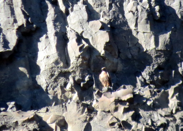
Everyone enjoyed the Artists Paint Pots and I tried several methods of catching the bubbling mud with the camera. We continued on to the Monument Geyser Basin and hiked the trails. Then we found our way to the Norris Geyser Basin checking out its wonders. While standing in line for the restroom a fellow said that he had just come from the Artists Paint Pots area, where two wolves had been spotted eating on an elk they had brought down. We loaded up and drove back the four miles to see what we could see.

There was a crowd gathered on the side of the road just north of the paint pot turnoff. Rangers were present keeping an eye on the tourists. We pulled off the road and found a spot out of the way, but where we could see a white female feeding on the carcass. We watched and took some photos. The wolf was about fifty yards away and hidden behind some brush and trees, but using my zoom I did what I could to capture the moment.
Linda was so excited. This was one of her bucket list items, wolves in the wild! She was able to talk to a lady standing next to her who knew quite a bit about these two particular wolves. She said the white female was about ten years old and was once the alfa female of the Hayden Valley pack of wolves. She and her alfa male mate had been together eight years. They were run out of the pack by their daughter and her mate sometime in the past two years and have been fending for themselves. We did not spot the male because he was hiding in the tall grasses, probably due to all the humans hanging around.
The female drug the carcass further into the trees and we could no longer get a good view. We returned to the truck and drove back north past Norris and on into Mammoth Hot Springs.
We hiked the trails of Mammoth as the weather changed and the skies grew darker. The last bright sunny photo I got was of the white cascades of the upper rock formation. After that, the sun went away.

Leaving the hot springs and entering the town of Mammoth we were greeted by a heard of elk sauntering around town. When we hit the junction we turned right and headed to the Towers-Roosevelt area and beyond to see Tower Falls.
We finished out our loop by driving through Canon Village and back through Norris to Madison. All along this route we spotted bison up in the hills grazing without a care in the world.

Following the Madison River back toward the park entrance we, once again, came upon the heard of cow elk grazing along the river bank. About a mile further on we stopped where we spotted a bull elk grazing in the middle of a field. He was a big fellow and I was able to get some good photos ending a very busy long day.
That evening we sat in Jill and Barry’s trailer and shared photos talking about the events of the past several days. The next morning we said our good byes. Jill and Barry continued on through Yellowstone to Jackson Hole Wyoming and Linda and I turned north and headed home.

On our trip back up we turned off highway 191 and on to highway 287 where we followed the banks of Hebgen Lake to the Madison River Canyon Earthquake Center. Though the earthquake center was closed for the season, we stopped and visited the memorial boulder where a plaque had been placed remembering the 28 people who were killed the night the mountain fell.

On the night of August 11
th, 1959 my cousins were camped in a camping area next to the Madison River. At 11:37 PM the earth shook and the mountain top came down killing my Uncle Purly Bennett, and my cousins Carole, Tom and Susan under tons of rock and debris. Just moments prior to the quake Phillip Bennett had gotten up out of the tent to use the restroom. My Aunt Irene had noticed this and had gotten out of the tent to see if Phillip needed anything.
When the mountain fell they were both pushed by the tornado-like winds that preceded the mountain side of rock. Both were later found a quarter mile or more from their original camp area, both were seriously injured but had survived.

They were rescued and sent to Ennis Montana to the hospital there. My Dad traveled down to Ennis and spent a long time with them as they underwent many operations and a long recovery.

I remember very little about that terrible event. I was four and a half and about all I could recall was a feeling of great sadness, seeing my parents crying and then my father leaving for a long time.

Irene and Philip lost so much that night but were able to regroup and both lived on and led long and wonderful lives. Aunt Irene remarried a wonderful man named Jack Dunn and they lived up in Hope, Idaho until their passing. Phillip married, moved to Seattle and helped raise a family of three daughters. He is retired from Boeing International and still in the Seattle area.
Linda and I read the information at the center took pictures and drove on up highway 287. In Ennis we stopped and ate a late breakfast and then continued on to I-90. We drove on west to Beavertail Hill State Park where we stayed for the night. Linda and Kobi spent the afternoon outside in the sun playing fetch and reading (Kobi did the fetching, Linda did the reading) and I worked on the computer getting everything into the blog. We ate dinner and went to bed. We had a leisurely morning. I polished up the blog and Linda went for a run. We packed up and drove home. What an adventure!
During our exploration of the park we all kept making the same statement. “What would it have been like to be the first person to visit this amazing place?” We talked about this over and over. All we can really say is that we are so glad someone had the foresight to preserve so much of this and that we will
 Kobi had a lump removed from his backside today. As you can see the area had to be trimmed a bit before the surgery. TRIMMED A BIT! Oh my gosh, they shaved the entire rear area. I guess that's OK because the Dr. said he would have to make a four-inch incision in order to get the lump out. He only had to cut it three inches. So the poor boy has that going for him.