
Wait, before we start telling you all about this next adventure, I'd like to point out a few things about my Canyonwren Travels Blog. This post marks the 1,000th entry. I started posting in 2005 and have been able to keep describing our adventures in this form for seventeen years! Even more astounding is that I have had over 146,653 visitors in that time. I think that is very cool, especially since I had never thought of writing as being fun. It has sort of grown on me.
 |
| Note the Ocotillo on the hillside. |
Our first stop on this leg of the adventure is Kartchner Caverns State Park located near Benson, AZ. We have booked four nights in the park campground and will meet up with Steve and Jodie Nelson to explore together. We pull into the campground and the very next rig to pull in behind us was the Nelsons.

We changed our plans and Jodie cooked up some wonderful enchiladas. I was tired and we spent the rest of the evening chatting before turning in and getting some sleep.

We met our Park Ranger in a seating area behind the center and listened to the story of how and when the caverns were discovered. This informative session lasted about 20 minutes and then we loaded into an electric tram and were taken out into the hills where we started our tour of the caves. Everything about this site is pretty amazing. The discovery, the campaign to make it a natural historic site, the excavation and construction of the entries to the caverns, and finally the precautions are taken to keep the caves as pristine as possible.
One of the first facts we learned is that the plant Ocotillo grows best in soil that is well-drained and contains limestone. Caverns are formed in limestone when water runs through the minerals. If you are looking for caves, look for areas covered with ocotillo and you may be able to find a cavern. This is very apparent when you look at the plant growth above the cave entrances. Also, note that there are no saguaro cactus in this region. We must be at a higher altitude. Coming from Queen Vally to this area, it is very noticeable.
 |
| Bee art on a wall in Bisbee. |
The tour lasted about 1 hour 45 minutes. Our guide was very nice and did a good job of explaining the history and geology of the site. We all felt it was well worth the entry fee. Unfortunately, no cameras, phones, or backpacks were allowed in the caverns. They were very strict on keeping these underground treasures safe and uncontaminated. The entrance and exit to the caverns were sealed by huge heavy doors, like the sort on commercial deep freezes. Upon entering, we actually walked through a mister to help keep from drying things out. The caverns are kept at a constant 72 degrees with 98% humidity. This was VERY different from any cave we'd ever been in!
 |
| Yes, we walked up there. |
After we finished our hike we returned to the campground and had dinner and went to bed.

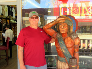
Our next stop was the famous town of Tombstone. You have all seen the movie, so I won't go into detail about the history. Our visit included lunch at Big Nose Kate's Saloon and a stroll down Main Street to the O.K. Corral. Everything in this town costs money. Do you want to see a gunfight? $15, pay at the door. Want a photo with a real cowboy? $$$. You get the idea.

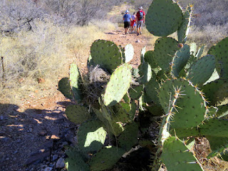
The morning was beautiful! Our hike took us on a trail they call the Foothills Loop with a climb to the Mountain Viewpoint. The total distance was about 3.5 miles and we enjoyed every step of our walk.


 |
| Eclectic doors and art items. |

 |
| Art map of Bisbee. |


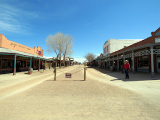
Tombstone

 |
| Steve is the one on the left. |


Foothills Loop Hike
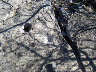 |
| Grinding holes are used to make flour from seeds. |


No comments:
Post a Comment