 |
| Sunset over Bruneau Dunes |
 |
| Our rig rests! |
The evening did cloud up and during the middle of the night, the wind picked up. For about four hours the wind blew so hard that twice during that time we rocked so hard that Linda grabbed my hand. I don’t think I have ever been in the camper in that hard of wind.
 |
| A water spout in the middle of nowhere. |
 By 6:00 AM the wind had died down and we were able to get on the road. The sun pocked out for about an hour and then everything changed. Once again the wind came up, but this time it was blowing directly at us as we ran north through Salt Lake City. Just past Provo the rain started and several times we were driving in fog and rain so thick we had to slow down.
We entered Idaho and the rain stopped but the wind was relentless. We were driving head on into the wind and our fuel consumption showed it. We made the turn to go to Bruneau Dunes State Park and noticed that we had very little diesel left and so we drove into the town of Bruneau and got $50 worth. From there we drove the six miles to the park and settled in. Everyone is hunkered down and the wind is a roaring.
 |
| Studying the info on the overlook. |

 Morning came and the wind had died, Linda went out for her run and I walked Kobi. The dunes are not far from the campground and you can see people plodding up to the top of each sand pile. There are two small lakes at the bottom of the two bigger dunes. Kobi and I walked out on the dock on one of the waterways. Beyond the dunes and the couple of lakes, there isn’t much here to see.
Linda and I took the Jeep and drove to a sportsman access road that led us down near the Snake River. We were looking for a waterfall called Crane Falls, but drove around and never did find the falls. We figured it was possibly a dry falls. So that’s our story and we’re sticking to it.
 After that adventure, we drove out along the Bruneau River to an overlook called the Bruneau Canyon Scenic Viewpoint. This overlook is about 800 feet above the river and is a spectacular place to look around.
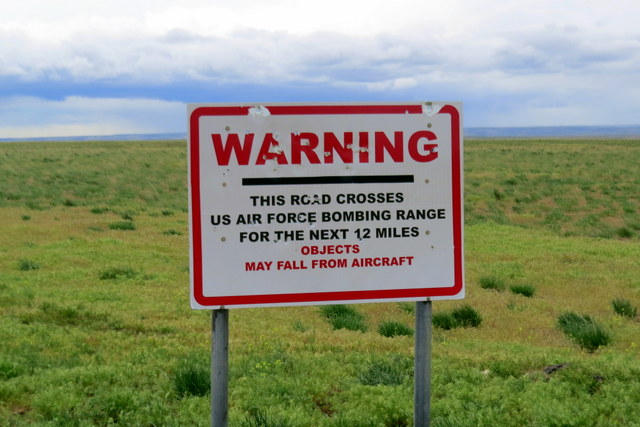
We got to the ridge top and entered the Saylor Creek Air Force Bombing Range. Yup, we ignored the warning signs. I figured we could avoid anything they dropped down on us. Anyway, why would they want to bomb a lapis blue Jeep?
 The viewpoint was about four miles into the range. Below was an amazing view of the river as the water cuts through huge cliffs of lava rock. This is a whitewater river run and as we watched we saw three kayaks disappearing out of site down river. The sign said that the stretch below us was called Five Mile Rapids and it was rated class 5.
 We looked up river and noticed a blue cataraft working hard in the rapids. Looking closer we found that there was a guy standing on a rock on river right and then we noticed three people gathering on river left. A flipped boat came into view below us and the cataraft was trying to catch it. Upriver a kayaker was spotted checking on the four people that were on river right and left. Then he joined the catarafter on river left. The flipped boat went through the rapids and I watched it float out of sight. We knew that we had three people on river left and they were working their way downstream to get together with the others in their group. The guy on river right was OK, but needed to get across to the rest of the group. We didn’t know how many were in the party (we thought we counted 7), but the ones we saw were all OK from our standpoint. All we could do was get in the Jeep and drive.

Working our way back down from the overlook we noticed a small road on our map that said there was a private takeout for river use. We followed some folks into the spot by the river and when they got out of their truck we asked if they were picking up some boaters. Turns out that they were there to meet the group that we watched lose the raft downriver. We asked how many were in the group and they confirmed that the party numbered seven. We were happy to report that everyone was gathering together upstream, but that they had lost the paddle raft downriver. All were concerned, but they said that the group was very experienced and that they were confident they would make their way downriver. We found out that there was about nine miles of slower water after the rapids, so hopefully they could get everyone together and make their way downriver on the cat and catch the flipped boat.
 Linda and I waited around for a while and talked with the folks, but we decided that it was time to get back to camp for lunch and we left. We sure hope everything came out OK for the boaters involved. Like Linda said, it will probably be one of those stories told tonight at a bar that starts “No shit and there I was…”
Lunch was consumed and we rested for a while. Looking west you could see dark clouds building so I suggested that we take a hike over to the dunes and climb to the top of one. Linda was all for that so we hooked Kobi to his long line and we hiked over to the sand piles.
 |
| Breneau Dunes. |
 I had read that the tallest one was over 480 feet tall and Linda said that these were the tallest natural sand dunes in North America. We climbed from one end to the other. A sign in the parking lot said that there was an area where the two sand dunes met that created a vortex crater. No sand is deposited in the vortex area. I stood looking at the vortex in hopes that a pyramid door would beckon, but nothing happened. I guess we have a different sort of vortex here in Idaho than in Sedona.
The weather to the west was looking blacker and more rain-like, so we retired to the camper. Dinner had been in the crock pot all day and we could smell the sesame chicken feast. The dunes provided today, with a little help from Stinky Jeep.
 |
| At the top of the dune. |
 |
| Walking the ridge. |
 |
| WATER! |


 By 6:00 AM the wind had died down and we were able to get on the road. The sun pocked out for about an hour and then everything changed. Once again the wind came up, but this time it was blowing directly at us as we ran north through Salt Lake City. Just past Provo the rain started and several times we were driving in fog and rain so thick we had to slow down.

 Morning came and the wind had died, Linda went out for her run and I walked Kobi. The dunes are not far from the campground and you can see people plodding up to the top of each sand pile. There are two small lakes at the bottom of the two bigger dunes. Kobi and I walked out on the dock on one of the waterways. Beyond the dunes and the couple of lakes, there isn’t much here to see.
 After that adventure, we drove out along the Bruneau River to an overlook called the Bruneau Canyon Scenic Viewpoint. This overlook is about 800 feet above the river and is a spectacular place to look around.
 The viewpoint was about four miles into the range. Below was an amazing view of the river as the water cuts through huge cliffs of lava rock. This is a whitewater river run and as we watched we saw three kayaks disappearing out of site down river. The sign said that the stretch below us was called Five Mile Rapids and it was rated class 5.
  We looked up river and noticed a blue cataraft working hard in the rapids. Looking closer we found that there was a guy standing on a rock on river right and then we noticed three people gathering on river left. A flipped boat came into view below us and the cataraft was trying to catch it. Upriver a kayaker was spotted checking on the four people that were on river right and left. Then he joined the catarafter on river left. The flipped boat went through the rapids and I watched it float out of sight. We knew that we had three people on river left and they were working their way downstream to get together with the others in their group. The guy on river right was OK, but needed to get across to the rest of the group. We didn’t know how many were in the party (we thought we counted 7), but the ones we saw were all OK from our standpoint. All we could do was get in the Jeep and drive.

 Linda and I waited around for a while and talked with the folks, but we decided that it was time to get back to camp for lunch and we left. We sure hope everything came out OK for the boaters involved. Like Linda said, it will probably be one of those stories told tonight at a bar that starts “No shit and there I was…”
 I had read that the tallest one was over 480 feet tall and Linda said that these were the tallest natural sand dunes in North America. We climbed from one end to the other. A sign in the parking lot said that there was an area where the two sand dunes met that created a vortex crater. No sand is deposited in the vortex area. I stood looking at the vortex in hopes that a pyramid door would beckon, but nothing happened. I guess we have a different sort of vortex here in Idaho than in Sedona.


No comments:
Post a Comment